
Covering New Jersey, no matter what the weather.
Friday, July 20, 2012

Wednesday, July 4, 2012
Hit by a "Derecho"

South Jersey knows the name of a new storm: derecho. For those of you who are unfamiliar with it, "a 'derecho' is a long-lived, rapidly moving line of intense thunderstorms that produces widespread damaging winds in a nearly continuous swath (NOAA). These winds are intense straight-line winds that reach over 58mph, often approaching 100mph. This intense line of thunderstorms must travel a minimum of 240 miles in order to be considered a derecho.
On Saturday June 30th, 2012, at approximately 1:00am, a Severe Thunderstorm Warning was issued for all of southern New Jersey. Upon receiving the message, I went to check the radar and was astonished by what I saw. The radar signature showed a large bow echo-I immediately knew the imminent threat of this storm. The storm cell quickly approached the region and knocked out power shortly after the warnings were issued. All you could hear was the howling wind outside. The storm worsened quickly, with wind gusts rapidly accelerating up to over 80mph. I personally wanted to step outside for a moment to see the wrath of the storm, but I was honestly terrified of the storm. As someone who enjoys experiencing the wrath of nature, even this was too much. The derecho swept through South Jersey, delivering it's unforgiving winds, causing widespread damage. Within an hour, the worst of the storm was over, and everything was dark.
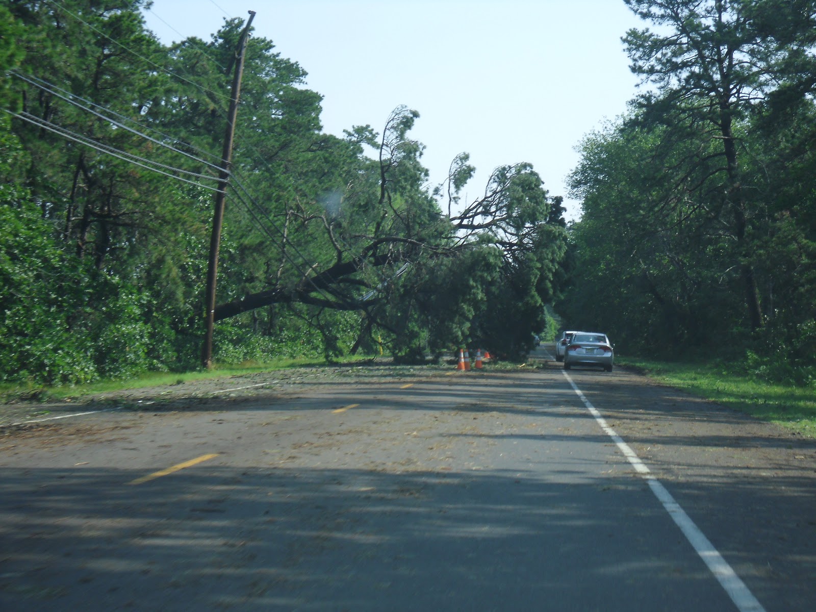
When morning broke, everyone was unaware as to the damage that had occurred from the storm. As I drove down the street and turned out of my development, Rutgers bound for a club meeting, I was struck with this scene just a few hundred feet away:

Atlantic, Cape, Cumberland, and Salem counties are struggling to recover from this monster storm. Utility crews from around the nation came over and helped our recovery efforts and we were grateful for their service. Its being reported that it could take over a week to restore power to all customers; my family struck lucky and received it back in 4 days. For the most part, people remained calm through the chaos, helping one another and being patient.
As for the derecho itself, the storm began in the Mid-West, around Illinois and traveled it's way into the Mid-Atlantic, wreaking havoc throughout the Central Atlantic. Wind gusts were measured up to 87mph in Atlantic City International Airport. The system lasted approximately 18 hours and traveled 800miles from the Mid-Atlantic, through the Central Atlantic, into the Atlantic Ocean. The damage was widespread and massive. In total, 22 people lost their lives in the storm.



Thursday, May 17, 2012
Forecasts are back! Sunny for the weekend, rainy start to the week?

WeatherCoats is happy to bring back its Extended Forecast for the summer! For the weekend, we're looking at some nice conditions overall with sunshine and comfortable temperatures. For Monday, we're watching a coastal storm as forecast models are still in a slight disagreement. The NAM and EMCWF (European) forecast models are suggesting that there will be some decent rain from the storm on Monday while the GFS only suggests some light rain. So in the forecast I'm putting mostly clouds with a chance of a good shower for Monday. As for Tuesday, all the models are in agreement that a weak cold front will push through and give us a little wet weather for the day with a few lingering showers for Wednesday. Conditions look to be clearing out by Thursday for a nice, warm day.
Looking ahead: Memorial day weekend looks to be mostly dry, but there could be a few showers...
Thursday, April 5, 2012
My April Fools Day Forecast!
So for the first time ever, someone recognized me from doing the weather forecasts for WeatherWatcher! To be honest, I was a bit taken back and at first felt a bit... awkward, but afterwards I felt flattered that someone recognized me, and even knew my name! My April Fools Day 2012 forecast must've stuck with them (not in the same way my April Fools Day 2011 blooper reel sticks to people hahaha).
Saturday, March 24, 2012
A Cooler Forecast for the Week
A cooler day today with cloudy skies and rain later on tonight and into tomorrow. Sunny skies come back for the week, but the cooler temperatures linger.
Sunday, March 4, 2012
Subscribe to:
Posts (Atom)